GEOB 270 Lecture Notes - Lecture 3: Big Data, Environmental Impact Assessment, Survey Marker

14 Sep 2018
School
Department
Course
Professor
Document Summary
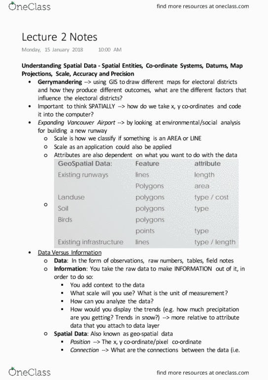
Understanding spatial data - spatial entities, co-ordinate systems, datums, map. Graphic scale --> you can see approximately how big the scale is. Verbal scale --> a scale that defines directly how large the area is. You have to ensure that when using the scale, you have to be careful in choosing which scale to project your map. Scale and gis --> gis stores scale independently --> so they will not prompt you with errors if the scale is too distorted. If the data was captured at a scale that was too small a scale then you can"t zoom in. If the data that was captured was too large of a scale, then you will have to generalize. Accurate + precise co-ordinates --> right in the center of both co- ordinates. Accurate + imprecise co-ordinates --> not that close to the bulls eye, thus may indicate that there may error in the datum and error in generating it on the screen.