GEOB 270 Lecture Notes - Lecture 4: Soil Texture, Process Modeling

25 Dec 2016
School
Department
Course
Professor
Document Summary
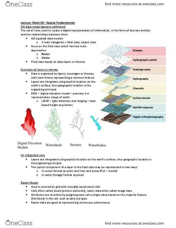
Concept of a model in gis: two ways. Capturing natural/social process with gis: take different data layers, perform analysis answer. Information = data + meaning knowledge + information + purpose + context i. e slope + aspect + precipitation + temperature = avalanche risk model: three process to simplify complex situations: Combining data sets to simulate natural process. Modelling world in gis: obtaining spatial/attribute data. Secondary data(acquired: dimensions of a gis dataset. Gis data models: two dominant representations. Each pixel = different numerical value, then represented with colour and shade. Some forms of data are better represented in one form than another. Gis analytical models: i. e lines are generally better represented in vector than raster: retrofitting the spatial data into a model, to deduce a result and answer a question. Spatial data: purpose: dictates context of dataset, quality and detail, map = biased towards purpose for which data was collected. No such thing as true data: three components: