GEOG372 Study Guide - Midterm Guide: Background Radiation, Lidar, Interpolation

31 Oct 2016
School
Department
Course
Professor
Document Summary
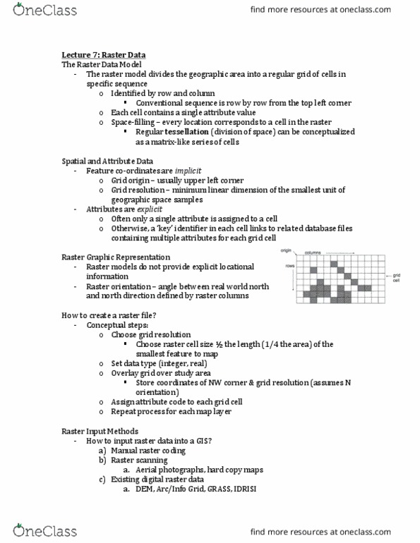
Use local drawing coordinates *survey control points* Focused on graphical representation of objects, and cannot store relationships. Individual objects do not have unique identifiers *depends* Computer cartography (graphical) data models similar to cad,m used to digitize paper maps. Array of cells, represent real world objects. Cells can hold attribute values based on one of several encoding schemes including categories, and integer and floating-point numbers. Multiple attributes stored for each cell in a value attribute table where each column is an attribute and each row either a pixel or a pixel class. Raster data usually stored as an array of grid values, with metadata (data about data) held in file header. Typical metadata include geographic coordinates of upper-left corner of grid, cell size, # rows and cols, and projection. Used in gi dbase bc of the. Quality of functional tools for operations -> topology/networks. Each object in real world classified into geometric type.