MAST382 Study Guide - Midterm Guide: Remote Sensing Systems, Fluorine, Boron

19 Oct 2016
School
Department
Course
Professor
Document Summary
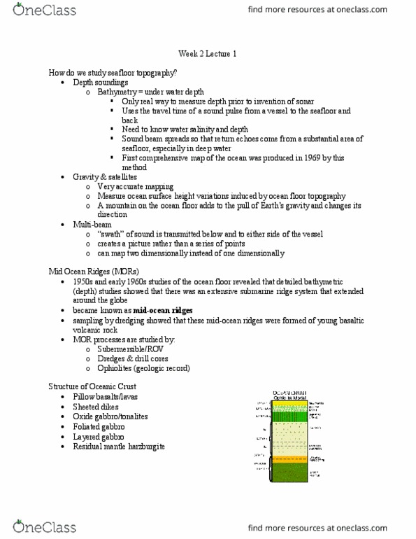
1872 challenger expedition- first systematic study of the oceans. 1950s - undersea mountain chains of the oceanic ridges were found. 1959- first comprehensive bathymetric map of the oceans. Soundings made by lowering a line into the water with a lead weight attached. Good for top 10cm, sandy sediments, larger organisms. B ad for preservi ng sedimen tary record, high contami nation from seawate r. Rotary coring good for harder sediments, rock. Some areas of seafloor are partially covered with manganese nodules and phosphorite nodules. Corers and drills are not able to sample surface rocks so dredges are commonly used. Dredge is ent of metal chain held open by metal frame. Speed and direction of currents can be computed from salinity and temp distributions. Movements of water can also be studied by radioactive tracers. 3 basic approaches of direct measurement of currents. Measuring currents- drifters, drogues (measure variable current speed and direction with depth), and floats.