GEOG220 Study Guide - Midterm Guide: Automated Airport Weather Station, False Color, Partly Cloudy

3 Apr 2018
School
Department
Course
Professor
Document Summary
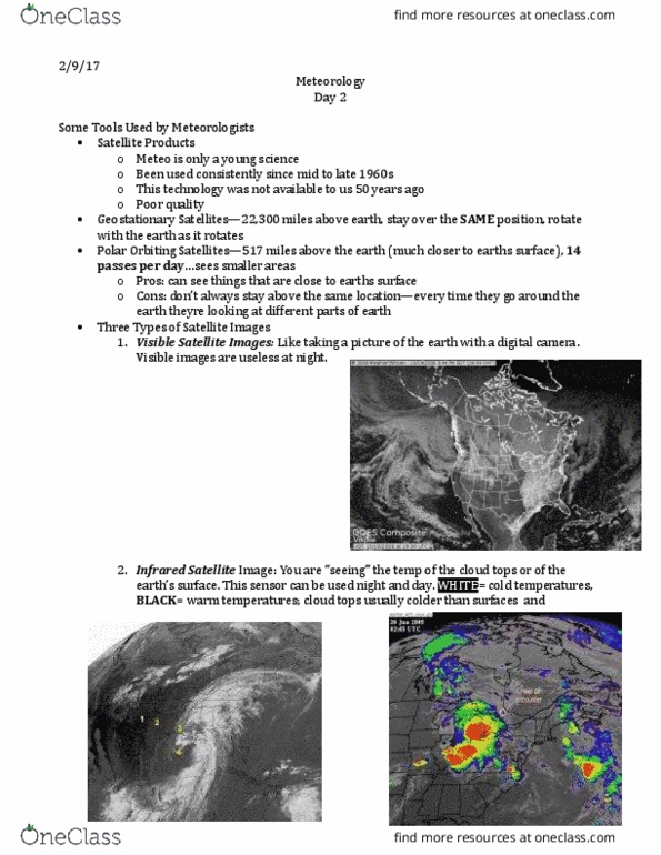
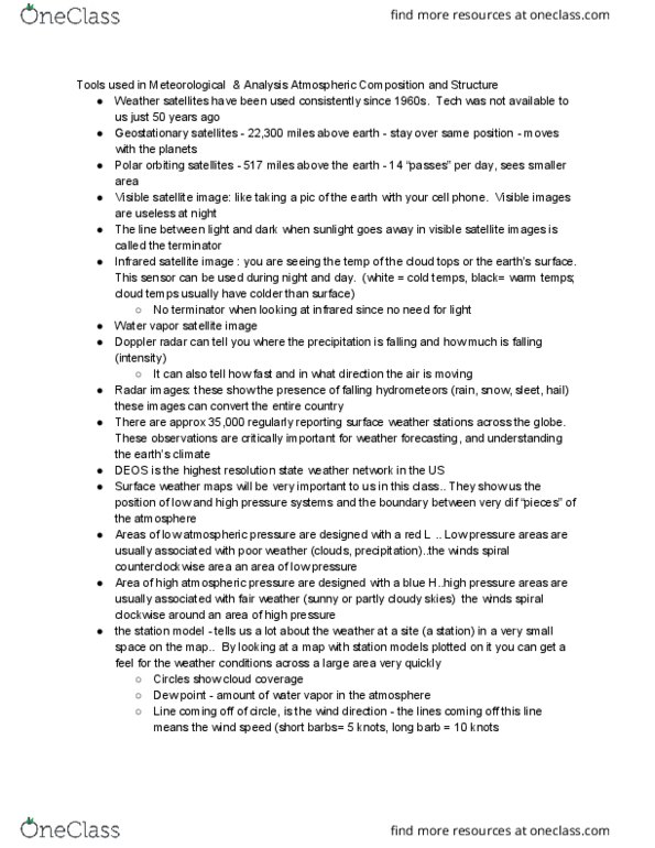
Geostationary sat lites: 22,300 miles a over earth; stays over same position. Polar orbiting satellites (poes): 517 miles above earth;14 passes per day; sees a smaller area. Tells where precipitation is falling and it"s intensity. Tells how fast and what direction the air is moving. Us doesn"t share radar data with canada radar data. Radar images: show presence of hydrometeors (rain, snow, sleet, hail) Important for weather forecasting and understanding earth"s climate. 70% (the ocean) of earth"s surface with no weather observations. Delaware environmental observing system (deos)- highest resolution weather network in us. Winds spiral counterclockwise around area of low pressure. Associated with fair weather (sunny, partly cloudy) Cold front : cold air moving in to replace warm air. Teeth and circles point in the direction the front is moving. Warm front: warm air moving in to replace cold air. Station model: weather at a specific place or small place on map.