01:460:207 Midterm: Environmental Geology Exam 1 Study Guide

10 Apr 2017
School
Department
Course
Professor
Document Summary
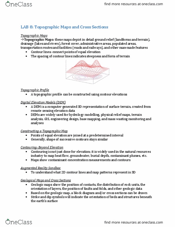
Map flat representation of earth"s surface drawn to specific scale. Topo maps represent elevation of landforms (m or ft above sea level) Intersection of a glass sheet with earth"s surface at different elevations. Elevation changes are represented by contour lines. 5th line is bolded: lines never cross each other. Bathymetric lines represent depth of landforms below sea level. Meteorologic lines represent constant temperature, pressure, etc. Magnetic lines represent equal magnetic field strength. Stream any body of water confined with a channel. Drainage basin region which a stream draws its water. Water enters by: precipitation, melting snow/ice, groundwater discharge. Water leaves by: evaporation (evapotranspiration, discharge from stream (ex. into ocean, groundwater recharge. *the change in the mass of in the basin is = to the mass of entering - the mass of leaving a basin. Discharge (q) the volume of water flowing through a given cross-section in a specific length of time.