EARTHSC 1G03 Study Guide - Quiz Guide: Geographic Information System, Web Mapping, Remote Sensing

4 May 2016
School
Department
Course
Professor
Document Summary
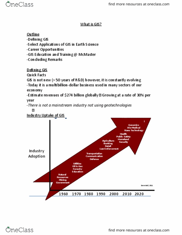
Not new around for more than 50 years of r&d). Growing at a rate o 30% per year. No mainstream industry doesn"t use gis to some degree. 1 of 3 main mega technologies for the 21st century and promises to forever change how we conceptualize, utilize, and visualize. Spatial relationships in science, research and commercial application. Collection of hardware, software, people, data, app/method. Toblers law: everything is related to everything else. Close things are more related than far away things. Works by linking data to place: a specific place where something is someone is located or an event takes place. A field worker using a gps: if you have a spatial reference, geo tagging. Change detection (how thing has changed over time) They measure reflectants based on the sun. 7 is the band they use for geology and rock identification. You can see rock and ice is no longer there.