GEOG 1216 Chapter Notes -International Date Line, Google Earth, Great Circle

Document Summary
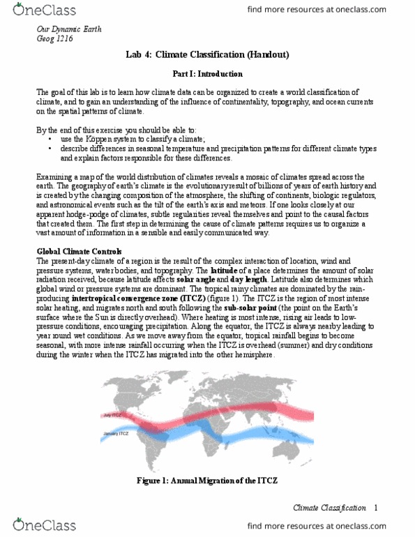
Lab 1: introduction to geography (handout: latitude and longitude. The most widely used global coordinates system is latitude and longitude. Latitude: ranges from 0 (equator) to 90 n and 90 s (the poles). To identify a location along a parallel you must include whether the point is north or south of the equator. Longitude: ranges from 0 (prime meridian) at greenwich, england to 180 e and w (the. International date line is approximately the 180th meridian). To identify a location along a meridian you must include whether the point is east or west of the prime meridian. Degrees of latitude and longitude may be subdivided into minutes and seconds. There are 60 minutes in a degree; 60 seconds in a minute. Note that these are measures of distance not time. The symbol for minutes is: " the symbol for seconds is: . Eg: 40 07"30 n is read: 40 degrees, 7 minutes, 30 seconds north latitude.