Geography 2152F/G Lecture 3: Lesson 3-3

17 Feb 2022
School
Department
Course
Professor
Document Summary
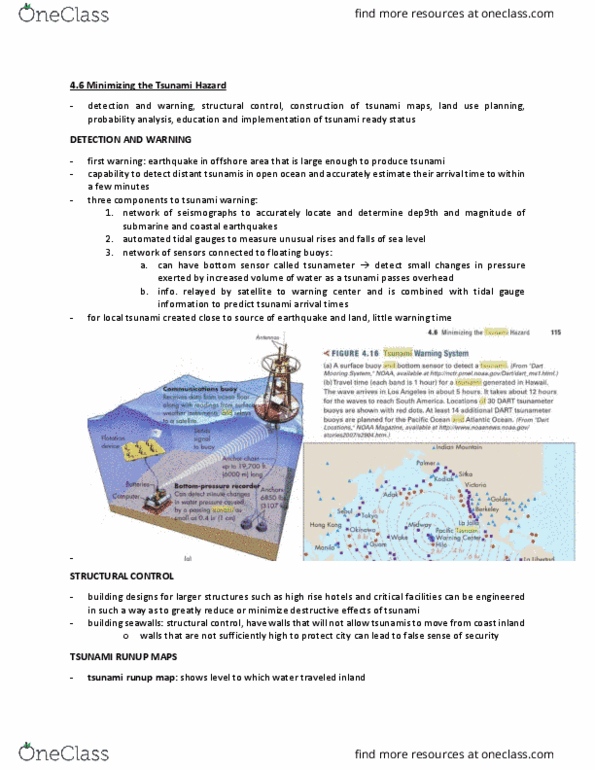
The pacific ocean warning system uses a network of seismographs to estimate earthquake magnitude. Sensors electronically connected to buoys verify that a tsunami was produced. They rest on the seafloor and measure changes in water pressure passing over them. Damage can be minimized through regulations on buildings and structures. Some cities in hawaii require flood proofing measures such as basement window sealing and bolting homes to their foundation. Concrete levees are other preventative measures but can be very expensive. Offshore barriers are only feasible outside cities with very large populations. Offshore barriers are like levees, but they are in the water and anchored into the seafloor (as opposed to levees which are anchored into the shoreline). Maps showing the geographic area that can be potentially impacted by tsunamis are created to help plan for future events. Historical records, geologic data, and aerial photography aid in making the maps.