GEOG 7 Lecture Notes - Lecture 5: Geotagging, Universal Transverse Mercator Coordinate System, Spheroid

Document Summary
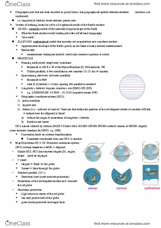
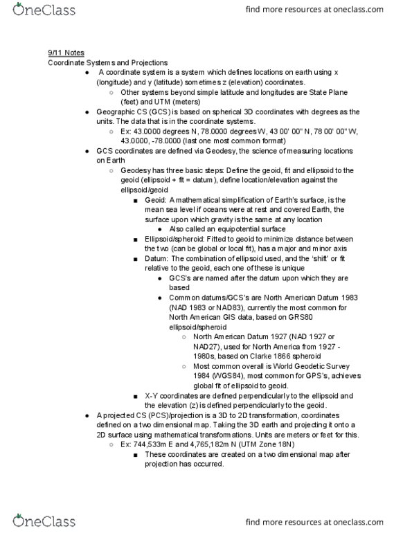
Geoid: converting earth from 3d to 2d: accurate representation of earth"s surface, natural extension of the msl surface under landmasses of the world i. e. world without surface anomalies and tides, used to determine elevation. Angular measure: latitude and longitude: global in extent, angles measured from the center of the earth, parallels and meridians: parallels run east and west, meridians run north and south, degrees, minutes and seconds (dms) to decimal degrees (dd) Common projections: universal transverse mercator: developed by us military but commonly used, conformal: preserve angular relations | equidistant: preserve distance | equal area: Preserve areas | which one you choose depends on your purpose. Tissot"s indicatrix: distortion of landmasses depending on projection. Geocoding: assignment of geographic coordinates to locations. Geotagging: assigning location information to various media. Geoparsing: assigning location information to text and discourse. Creating geometric representations for locations from descriptions of locations. Interactive rematching: sophisticated user interface to match addresses.