GEO 481 Lecture 3: GIS Data Models

4 Mar 2019
School
Department
Course
Professor
Document Summary
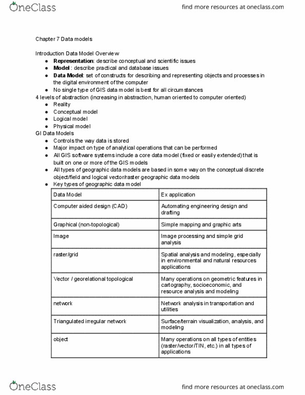
Gis data model: an abstraction and approximation of geographic entities in the real world. A lake is abstracted as a polygon in a gis. The boundary of the polygon approximates the real boundary of the lake. That depends on how we conceptualize the world. The entire space is empty, filled with discrete objects. The entire space is full and continuous, filled with values. Geographic objects are represented as points, lines, and polygons. Lines: a sequence of points in a direction (from, to) Polygons: a sequence of points in a direction (counterclockwise or clockwise) Topological properties: the spatial properties between geometric features (geographic objects) Topological properties can be stored with vector data models. An array of grid cells (or pixels) One grid cell is one unit or holds one attribute. Every cell has a value, even if its missing. A cell can hold a numeric value (number) or a nominal value (letter) standing for an attribute.