EMSE 6340 Lecture Notes - Lecture 4: Arcgis, Decimal Degrees, Cartesian Coordinate System

3 Jun 2016
School
Department
Course
Professor
Document Summary
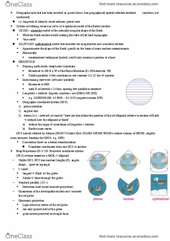
Class 4 notes: coordinate systems and map projections. Coordinate system - reference system that represents the locations of features, imagery, and observations in a common geographic framework. 3 types: geographic coordinate systems (uses latitude and longitude) A circle is divided into 360 degrees, one degree = 60 minutes, one minute = 60 seconds (sexagesmal system) The graticule measurement varies on the place on the surface of the earth: projected coordinate systems (designed for a flat surface, grid systems (use a plane or x-y coordinates) The earth is not a perfect sphere: slightly squeezed at each pole with a slight bulge in the middle (slightly ellipsoid in shape), caused by the centripetal force of the earth"s rotation. But a geoid (= earth-like) is the most accurate model than the ellipsoid (cannot be defined by mathematical terms as we can with a sphere or an ellipsoid). The three shape-models are used for different purposes in cartography: