PCB 4043 Lecture Notes - Lecture 10: Landscape Ecology, Data Analysis, Ecolo

16 Jun 2016
School
Department
Course
Professor
Document Summary
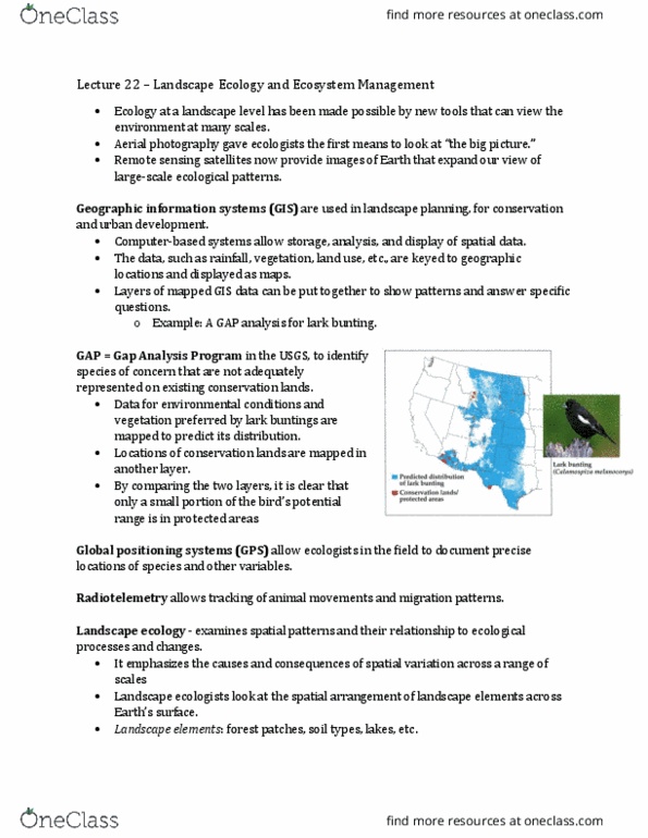
The technology involved is what"s making big strides in landscape ecology: putting someone in space to see, aerial photography, remote sensing satellites, etc. Gis (geographic information systems) are used in computer mapping: allow us to map and let us store information in data layers. Gps allow ecologists in the field to document precise locations of species and other variables. Radiotelemetry allows tracking of animal movements and migration patterns: you can tag animals and track where they travel to, what movement patterns they do, what the actual home range of an animal actually is. Data analysis and gis continually improve as computers improve and statistical methods evolve to handle the huge influx of data. Grain- size of the smallest homogeneous unit of study. Extent- boundary of the area or time period encompassed by the study. Disturbances can cause the patterns that you see in heterogeneity: look at the effects of a disturbance (like a fire) and how it changes the landscape.