GGR272H1 Lecture Notes - Lecture 2: Arcmap, Data Acquisition, Digital Elevation Model

18 Mar 2018
School
Department
Course
Professor
Document Summary
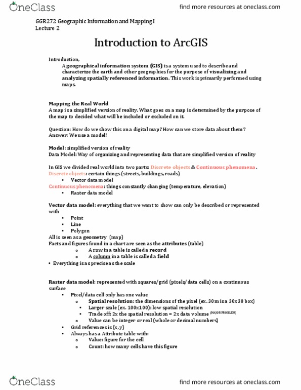
Mapping in the real world: taking something from the real world and putting it on a map, objective: mapping things, what do i (cid:449)a(cid:374)t a(cid:374)d do(cid:374)"t (cid:449)a(cid:374)t i(cid:374) (cid:373)y (cid:373)ap you could put anything on your map. In this case, it is elevation: a colour scheme that shows the elevation every place has an elevation. Representation strategies for mapping: geo data are constructed by measuring representative sample of location, vector/raster are two distinct sampling strategies. In arcmap arc catalog there is a geo database a storage container that we can put feature class: point, line and polygon have a different icon that shows in this area. Table basics: tables contain rows, all rows have the same columns, each column has data type (integer, decimal, character, date, a series of relational functions and operators is available to operate on the tables and their data elements.