EESA09H3 Lecture Notes - Lecture 1: Puffy Amiyumi, Cumulonimbus Cloud, Cool Air

3 Jun 2018
School
Department
Course
Professor


Hurricane IRMA is a tropical hurricane
Know about the Hurricane IRMA for the exam!
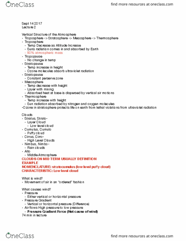
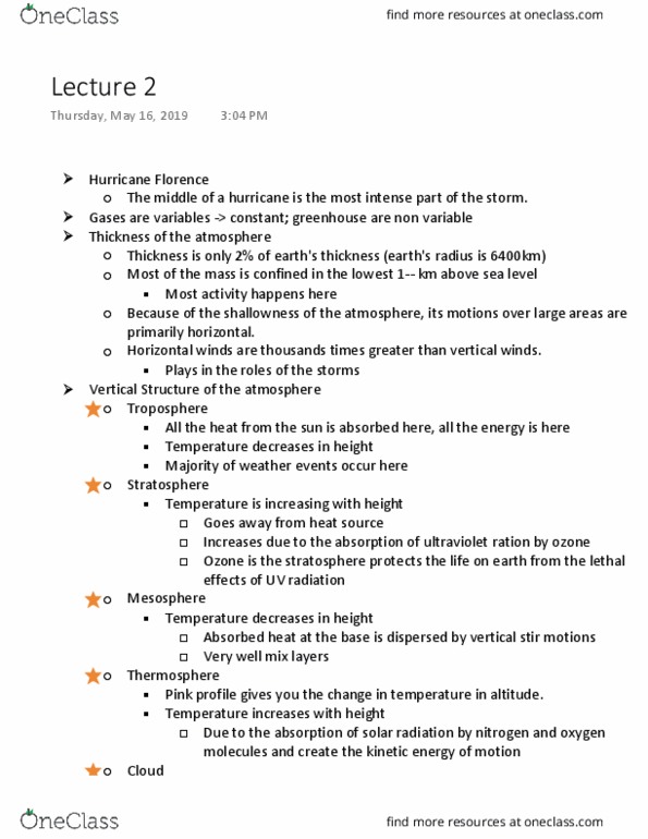
Vertical Structure of the atmosphere:
1. Trophosphere
a) Responsible for all weathers
b) Temperature decrease with altitude
c) Tropopause= no change in temperature with altitude (straight line)
2. Stratosphere
a) Temperature increase with height
b) Lots of ozone molecules
c) Stratopause= no change in temperature with altitude (straight line)
3. Mesosphere
a) Temperature decrease with height
b) Mesopause= no change in temperature with altitude (straight line)
4. Thermosphere
a) Close to energy source
b) Increase with height
Clouds can be classified by their nomenclature (system that is used to name something)
1) Stratus/Strato
a) Layer cloud
find more resources at oneclass.com
find more resources at oneclass.com

b) Lower leveled cloud
2) Cumulus/Cumulo
a) puffy loud
b) Lower leveled cloud
c) Layer cloud
3) Cirrus/Cirro
a) High level clouds
4) Nimbus/Nimbo
b) Rain clouds
5) Alto
c) Middle cloud
d) Dim light from the sun
6) Cumulonimbus
a) Thunder cloud
b) Associate with thunder and hurricanes
c) Looks like scales of a fish (Mackerel Scar)
Look at slides 21-27 in lecture 1-2 for clear images of different types of clouds
Era of winds
1) Geological
2) Biological
3) Anthropological
Gradient=difference
find more resources at oneclass.com
find more resources at oneclass.com

The attached image has clear explanation of the pressure gradient and its function on the movement
of air.
In slide 30, the two parallel lines are known as isobars. At any given points on the lines have the same
pressure values.
The image shown above is a good representation of the movement of wind. Wind does not move in the
straight line, it will move in a wavy formation.
Why the wind does not fall on the surface level (that is ground)? Why all the wind is not moving upward
given the fact that air pressure decreases with height?
Ans: At the upper level, there are fewer air molecules and the molecules are held close to the earth
surface due to gravity. Gravity vs. PGF acts against gravity.
Coriolis force
High to low pressure creates pressure
gradient. It is the prime cause for win the
atmosphere.
In this image there are two isobars that are
not evenly spaced. The pressure gradient
varies (PFG). The closely spaced isobars have
greater pressure gradient force.
Application: Imagine that you are at Down
Toronto. When you are between buildings,
you feel the strong air because the air is
constricted. Whereas, when you are walking
at the streets, there is no air being
constricted. Therefore, weak wind is formed.
find more resources at oneclass.com
find more resources at oneclass.com
Document Summary
Know about the hurricane irma for the exam! Look at slides 21-27 in lecture 1-2 for clear images of different types of clouds. The attached image has clear explanation of the pressure gradient and its function on the movement of air. In slide 30, the two parallel lines are known as isobars. At any given points on the lines have the same pressure values. It is the prime cause for win the atmosphere. In this image there are two isobars that are not evenly spaced. The closely spaced isobars have greater pressure gradient force. When you are between buildings, you feel the strong air because the air is constricted. Whereas, when you are walking at the streets, there is no air being constricted. The image shown above is a good representation of the movement of wind. Wind does not move in the straight line, it will move in a wavy formation.