HIST115 Lecture 3: Lecture #3

20 Nov 2016
School
Department
Course
Professor
Document Summary
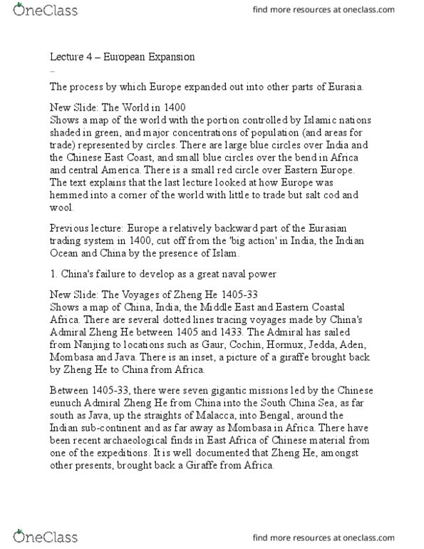
New slide: world trading systems 1400, shows a map of eurasia and. Southern europe: genoa and venice, iii mongol empire: silk road, Iv arab, v red sea, vi indian ocean, vii indian sub-continent and south east asia: cotton and spices, viii china and south east. Asia: porcelain and spices, ix trans- sahara: gold. The big commodity in europe was wool, traded from northern europe to the mediterranean ports, in contact with the eastern mediterranean world, trading into the central and northern mediterranean. There was then a large trading zone, the mongol silk road, connecting the east with the west, and the route used by marco polo. There was the arab zone, based around the red and arabian seas, which connected the. Africa with the arab trading zone, and also concentrated on the nile, delivering goods from the african interior to cairo, where they connected with the mediterranean.