GEOG 2480 Lecture 1: Week 1

19 Apr 2017
School
Department
Course
Professor
Document Summary
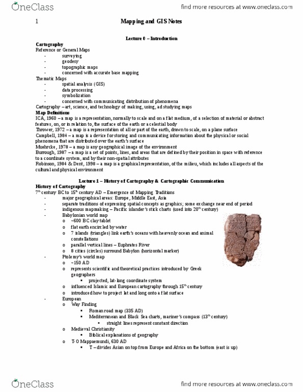
Reference or general maps: navigation, concerned with accurate base mapping. Thematic maps: how something is spatially distributed, concerned with communicating a specific phenomenon. Mapping is changing all the time: satellites etc. help do this. Is a grid system, helps measure scale: mostly on permanent material (paper, works of art. From this they can determine how far they are from that point. National surveys and thematic cartography: late 18th 19th century, western mathematics spreads throughout word, vast interior regions mapped, roles are split, surveyors and astronomers, mathematicians, etc. 20th century: maps readily available to general population: production costs continue to go down, maps used to sell things like middle income (cars, thematic mapping helps provide evidence for things such as earthquakes. Satellite imaging: started in the 60s, infrared radiation, gps, computers have allowed us to think about how we interact with our spatial data.