GEOG 2OC3 Lecture 4: TheIceAge

30 Jan 2019
School
Department
Course
Professor
Document Summary
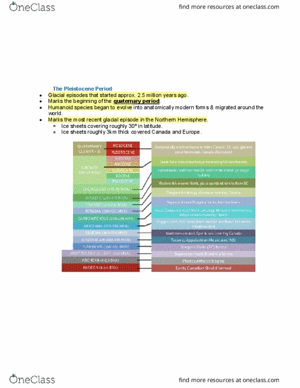
Pleistocene world map: this molldewide projection shows the earth during the pleistocene, global plate distribution has pretty much stabilized and glaciers have advanced to around 40 degrees n. Ice sheets roughly 3 km thick covered parts of canada and europe. Sun and moon on the earth"s equator; orbital eccentricity, axial precession and axial tilt: these (among many other factors) contribute to the amount of solar insolation that earth receives and influences ~ 26,000 year cycles of glaciations! Orbital eccentricity: earth does not orbit the sun in a perfect circle (figure 1). A departure from this circle is known as an ellipse (figure 2) an oblong shape which more closely resembles the summer and winter solstices and equinoxes. Axial precession: earth"s rotational axis also wobbles slowly (making a full circle every 25,000 years) causes by the gravitational pull of the sun and moon on the earth"s equator.