GEOG 2OC3 Lecture Notes - Lecture 1: Sedimentary Rock, Schist, Interior Plains

17 Sep 2018
School
Department
Course
Professor
Document Summary
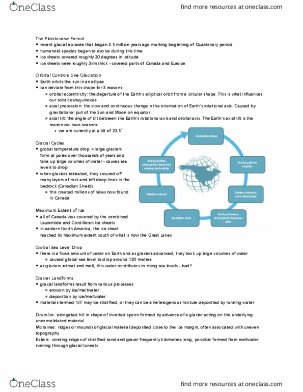
Glacial cycles: global temperatures drop large glaciers to form at poles, glaciers grow take up large volumes of water = sea levels drop, wisconsin glaciation- glaciers over 3km thickness covered canada. 25,000 years ago: canada covered by the laurentide and. Cordilleran ice sheets: eastern n. a, ice sheet reached its max extent south of the great lakes. Global sea level drop: glaciers advanced took up large volumes of water = global sea level drop ~120 meters, glaciers retreat and melt water contributes to rising sea levels. Glacial landforms: erosion by ice/meltwater, deposition by ice/meltwater, materials such as clay, rock, gravel etc. , (cid:862)till(cid:863) (cid:373)a(cid:455) (cid:271)e sorted or stratified or the(cid:455) can be heterogeneous mixture deposited by running water unconsolidated. Drumlins: elongated hills, shape: inverted spoon formed by advance of glacier acting on the underlying unconsolidated material, found around southern, on (peterborough) Moraines: ridges/mounds of glacial material deposited close to the ice margin, uneven topography.