GEOG 307 Lecture Notes - Lecture 2: Spatial Epidemiology, Emergency Management, Redlining

8 Feb 2020
School
Department
Course
Professor
Document Summary
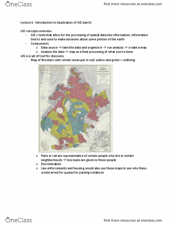
Set of tools you are considering where does crime occur/ disease mapping. Raster tools both raster by itself or dem specific to use for project (not covered in class) Can do a search on houses to buy/ real estate. Trade area analysis area in a company thinks that people from one area are going to go to a certain store. Spatial imaging data display of data and information within a coordinate system. Database management capability of gis to store, manipulate and provide access to data. Harm it will cause: goes beyond buffer and overlay, not every area will be fully/ equally effected, look at wind direction/ speed. If there is a spill only certain areas will be affected, and you can design an evacuation plan. Level 1: display spatial information: gps based selection of location and content of outdoor build board, maps showing location of service centers, atm locator centers.