GEOM20013 Lecture Notes - Lecture 9: Spatial Scale, Sampling Bias, User Guide

7 Jul 2019
School
Department
Course
Professor
Document Summary
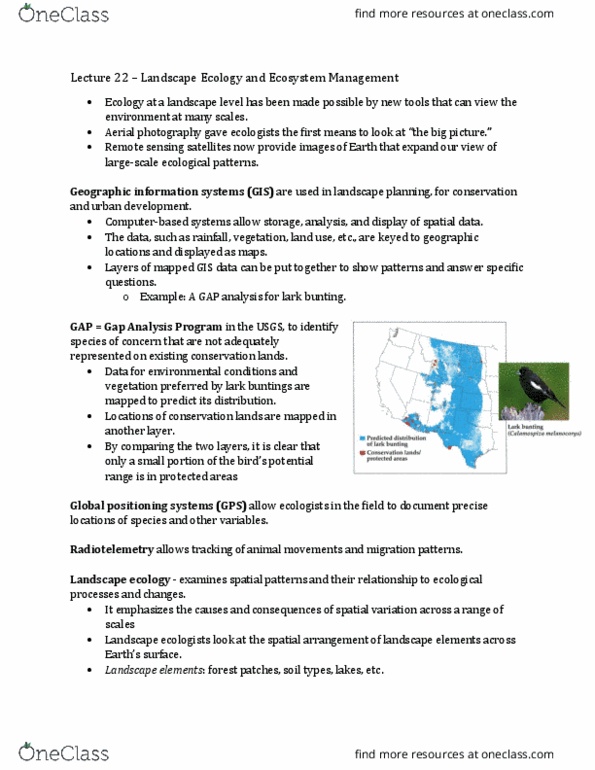
Lecture - application of gis to conservation and ecology. Species distribution models (sdm) are quantitative tools that relate the species occurrence data to the environmental variables to explain species-environment relationship and predict their geographic distribution. Gis variables interpolation of climatic variable, topographic derived variables (slopes, landforms, etc) , distance to features (water, roads, etc) Difference environmental factors tend to operate at different spatial and temporal scales. Most available data have only the locations of species presence. Spatial scale is important - extent and resolution. Sampling towards accessible areas can bias species distribution models. Geospatial: a small niche industry becoming more common in other industries such as health, insurance, real estate mapbox - making geospatial technology more accessible. Cartography is the practice of using graphics and text to represent spatial features of a space. Gis maps are data driven and not necessarily engaging. Other softwares can be used to improve maps (such as illustrator)