GGR201H1 Chapter Notes - Chapter 2: Radiocarbon Dating, Lichenometry, Remote Sensing

Document Summary
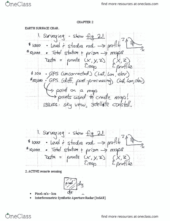
Manual surveying of fine-scale landscape features remain important tool. Gps relies on radio-based trilateration between constellation of broadcasting satellites and passive receivers. Must be able to lock onto signal from at least four satellites simultaneously. Remote sensing can gather large amounts of information quickly, but needs to be processed by computers and interpreted by models. Active remote sensing: instrument sends out pulse of energy, receives energy back, then analyzes characteristics of energy pulse as it returns to detector. Radar can be used to estimate surface roughness. If scale of roughness elements smaller than radar wavelength, surface appears smooth. If roughness large compared to radar wavelength, radar energy backscatters in all directions. Surface roughness is an indicator of surface age. Surfaces smooth over time with erosion and weathering. However, after long period, buildup of calcium carbonate in arid soils reduces porosity and limits infiltration of rainwater. Passive remote sensing: uses detector to measure amount and wavelength of energy emitted from surface.