GGRA30H3 Lecture Notes - Lecture 2: Location Intelligence, Environmental Impact Assessment, Killer Application

Document Summary
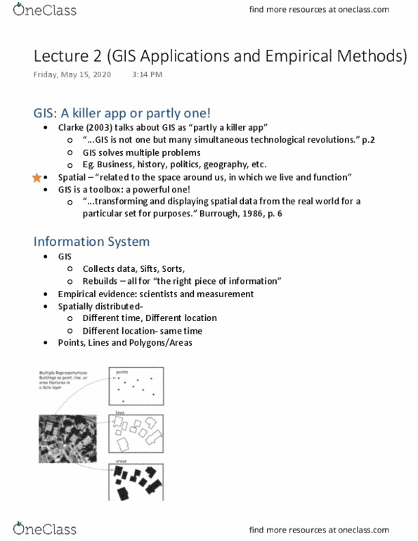
Quick recap: gis: a killer app or partly one? (multiple apps) Gis is not one but many simultaneous technological revolutions (solves multiple problems in multiple field) Spatial: related to the space around us, in which we live and function . Transforming and displaying spatial data from the real world for a particular set for purposes. Gis: collects data, sifts, sorts, rebuilds-all for the right piece of information. Empirical evidence: scientists and measurement (applying evidence in the system) Spatially distributed: different time, different location z9shape two different information. (location and time zones) could be display and visualize in the same map) Points, lines and polygons/areas (point is basically a dot, such as x and y, every pieces of land represented by x and y) (lines means connection of dots) (add all information together could be display as a 3-d space) Locations can be represented by all these three forms: a dot, lines or polygons)